Gusar
Shahdag

Shahdag (Shah - king, dag - mountain) is a mountain peak in the eastern part of the Greater Caucasus, located in northeast of Azerbaijan. No wonder this place is listed in the list of the most beautiful corners of the Caucasus. Situated in the north-eastern part of the country at the foot of Shahdag mountain this region is one of the most beautiful and interesting corners of not only Azerbaijan but the entire Caucasus. Its nature is extremely diverse: from forests to harsh sky-high mountains covered with glaciers of the High Caucasus. Here are the deepest canyons, rarest gorges, ravines, amazingly beautiful alpine lakes and waterfalls, complex in form mountain ranges, inaccessible passes. The territory of the district is a kind of connecting link between Europe and the Middle East. The local climate is the best for skiing. In winter, the air temperature is often kept at minus 20-22 degrees. For these and many other reasons, it was at the foot of Mount Shahdag that a modern tourist complex was created that meets all European requirements. The winter and summer Shahdag tourist complex opened in Azerbaijan in 2013 and provides all the necessary conditions for recreation and sports. Today, "Shahdag" has everything you need for outdoor activities. There are several hotels with a high level of service, four comfortable and safe lifts, ski and snowboard equipment rental. Also in the resort there is a medical aid point, ski school, extensive parking and a carpet path for the youngest winter sports enthusiasts. The complex is ready to please with a variety of cable cars: there are rope tows and carousels, and gondola cableways will soon appear. "Shahdag" is suitable for lovers of skiing, both with high and with zero level of training. There are slopes for beginners as well as for real pros. Each of the tracks is prepared using artificial snow generators, which allows you to make the ski season longer, and the tracks are better and more enjoyable for skiing. Gusar district was formed in 1930, when the Guba province was divided. Named due to its geographical location the "Northern Gate" the city of Gusar is the last large settlement in the north of Azerbaijan. It is assumed that human settlements in this territory appeared at the end of the 2nd millennium BC. Here, to this day, many historical monuments, various eras, as well as attractions of great interest to travelers, have been preserved.
M.Y.Lermontov House-Museum
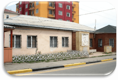
For anti-monarchist speeches and love of freedom the Russian poet M.Y. Lermontov (1814-1841) was exiled to the Caucasus. In the years 1825-26 he lived in Gusar. Here he wrote his works "Prisoner of the Caucasus" and "Ashug Gerib: Turkic Tale". A friend of the great Azerbaijani writer and thinker Mirza Fatali Akhundzade, the poet in his letter to his friend Raevsky emphasized that he had begun studying the Tatar (Azerbaijani) language which is important and spread in Asia as much as French in Europe. In Gusar Lermontov settled with his acquaintance (according to some sources, a relative), a military doctor, Lieutenant Colonel Alexander Alexandrovich Marshev. On the former Noble Street, later Lenin, his one-story house has been preserved. In memory of M.Y.Lermontov’s stay in Gusar near Marshev’s house, a high snow-white stele with a bas-relief of the great Russian poet and a memorial plaque on which Lermontov’s famous lines were written, written by him during his stay in this city:
"Greetings, the hoary Caucasus! I’m not a stranger to your mountains ... "
"As I loved, my majestic Caucasus, your sons warlike morals ...".

Anig Village
It is located 27 km southwest of the district center on the right bank of the Gusarchay River off the Gusar-Zindanmurug highway. Gusarchaya Valley (Anig Valley) covering 9 villages is also named after this village. In this high-mountain village located on top of a huge hill protected by natural barriers people have lived since ancient times. In the historical chronicle "History of Abumuslim" written in Arabic, several villages that existed in the Xth century in Azerbaijan are mentioned, including the village of Anig. According to legend the village is named after the local ruler Anig-aga. According to another version the toponym Anig is associated with the name of the Hun tribe. Initially, it sounded like "unyug" and later transformed into "Anig".
Anig Fortress
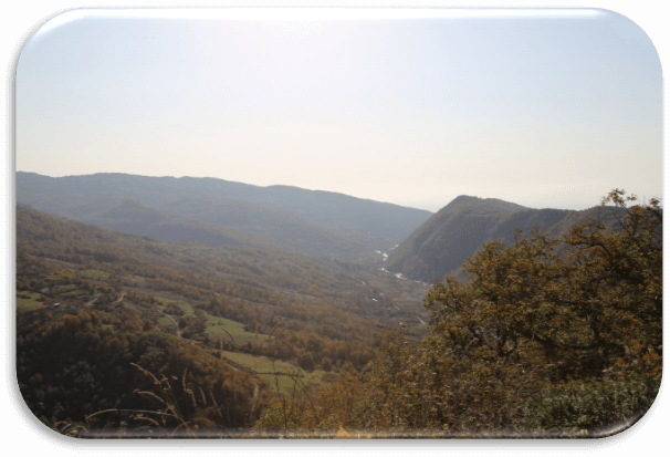
In this strategically important village, located on the slopes of Mount Shahdag, a fortress was built to protect against Arab invasions. Anig Fortress (also Enih, Enig, Anih), which oversees the Salavat mountain pass, is located at an altitude of 1100 m above sea level on the right bank of the Gusarchay River on a high hill with natural obstacles in the village of the same name in the Gusar region. In order to provide the best defense capability of the fortress its architect successfully used all the features of the relief. The fortress was located in the south of a gigantic hill with steep slopes. From the once superbly fortified fortress today only two fragments have survived. In the first case, it is a wall 15-16 meters long. In the second - the corner tower of the fortress gate. The width of the wall is 2 meters, the diameter of the tower is about 6 meters. The height of the remains of the fortress is from 5,8 to 9,3 meters. The place on which the fortress stands is built of rock stones and river pebbles. Based on data from the Georgian book "Chronographs" (XIV century), it can be assumed that the Anig Fortress, which existed from the 9th century, was destroyed in 1288. Among the locals there is still a tradition that the fortress was destroyed during the war between Christians and Muslims. In 1288, in the battles against the troops of the Golden Horde the Georgian Christian groups that were part of the defenders of the Anig Fortress were especially active, who served in the troops of the ruler of the state of the Khullagids of Argun Khan.
Taj Mahal Gusar
The mosque called “Mahalyn Taji” dates back to the XIXth century and is located in the village of Anig. 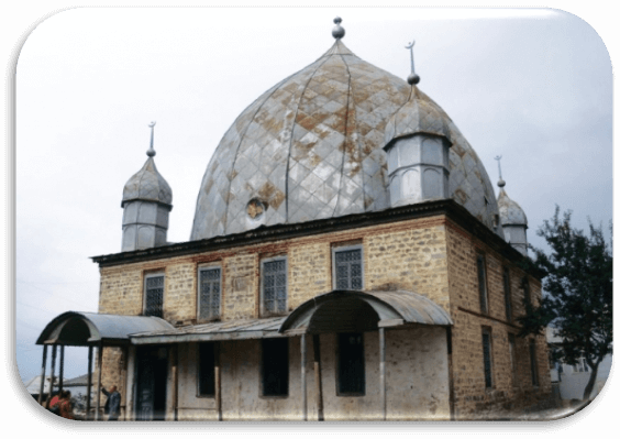 In Anig it has long been customary to build pompous, conspicuous buildings. They say that the construction of this mosque was ordered by a man who visited India, saw Taj Mahal there and decided to build his likeness in his homeland. Although it is claimed that the mosque built from raw brick was 300 years old, the plate on it says that it was built in the 19th century. The paintings on the walls of the mosque attract attention, although they have not been restored, but have retained their bright color. They are created by natural, vegetable paints.
Khazrya Village
In the XVth century the peace and tranquility of the northeastern regions of Shirvan were broken by Sheikh Junayd and his son Heydar, belonging to the Safavid dynasty. Thinking of capturing Shirvan Sheikh Junayd crossed the Kura River and invaded the borders of this state. The troops of Shirvanshah Khalilullah I blocked his path. In the battle held in 1460 near the village of Gypchag on the left bank of the Samur River the army of Gyzylbash was defeated and Sheikh Junid himself died. Murids (courtiers) of the sheikh transferred his body to the right bank of the river and buried in the village of Gyulkhan. We are talking about the village of Khazrya (or Yargun, as the locals call it) of the Gusar district which is 53 km from the district center. The village of Khazrya is famous for its pahlavans - heroes. Here they still hold traditional pahlavan competitions "Sim Pahlavan", which are an integral part of all public holidays.
Tomb of Sheikh Junayd
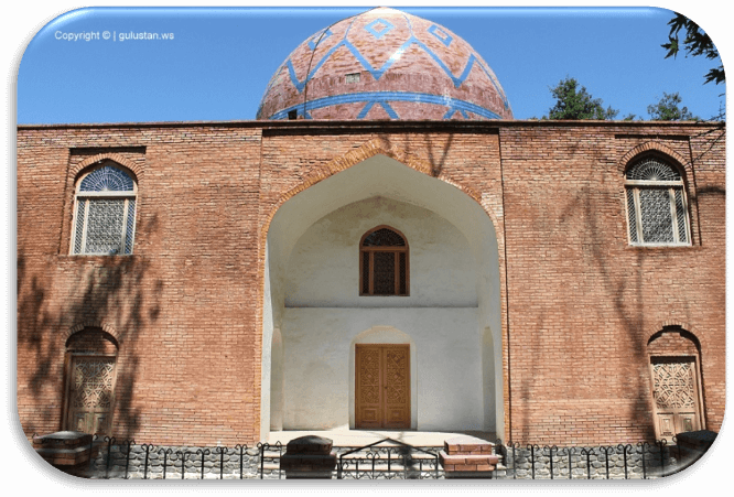
Built on the grave of Sheikh Junayd, the grandfather of Shah Ismail Khatai, the tomb is considered one of the most important historical and architectural monuments of the Gusar region. As already mentioned, Sheikh Junayd died and was buried in the village now Khazrya. The construction of the mausoleum over his grave was apparently much later. This is what the inscription on the northern facade of the currently existing complex of buildings narrates. There is evidence that the remains of Sheikh Junayd in the XVI century were transferred to Ardabil. In this regard it should be assumed that either the remains were transferred much later than the construction of the tomb, or the tomb was built simultaneously with the transfer of the remains. Given that by the time the Safavid mausoleum was being built, they were already powerful sovereigns, it is quite possible that after the transfer of the remains of his ancestor, who fell in the struggle to strengthen the power of the Safavid dynasty, Shah Tahmasib built this tomb as a monument to Sheikh Junideid, giving the structure the character of a funeral mosque. Near the tomb is an ancient cemetery where, as they say, the fallen soldiers are buried.
Laza Village
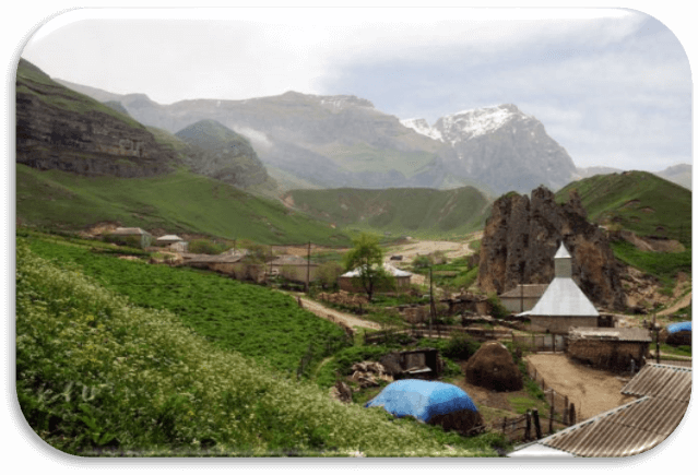
In Lezgi, this name sounds Latsar. Situated in a valley between the mountains the village consists of two parts. The second part is located on another slope of the mountain, on the banks of the Demirchay River in the territory of the Gabala region. They say that it was from there that the inhabitants of the village of Laza moved, who gave the new village the same name.
Laza village is located on the northeastern spurs of the Main Caucasian Range at the foot of the Shah Yailag high plateau and one of the highest peaks, Shahdag, its height is 4242 m above sea level. The village of Laza is located in a mountain basin at an altitude of 1300 m above sea level, on an ancient caravan route through the passes of the Main Caucasian Range (Kurve Pass) leading to the Southwest and Northwest spurs of the Greater Caucasus. The neighborhood of the village is very picturesque, numerous waterfalls flow from the rocks. Ethnic Lezghins live in the village, whose ancestors were Legs, whose history is connected with Caucasian Albania, one of the oldest states in Azerbaijan. Residents of the village of Laza live the usual life of highland settlements, housekeeping, keeping poultry, cattle and small cattle. The most famous historical monument of the village of Laza is a mosque located right in the center of the village, which is 300 years old. Laza is one of the most visited villages in Azerbaijan. There are many guests in the village both in winter and in summer. Foreigners especially like to come here. Tourists stop at the locals - in the rooms specially built in the courtyards of the villagers, all amenities are created for them, meals are also included in the service. The village consists of 26 houses in which about 130 residents live. There is a school with 4 years of education.
Laza Waterfall
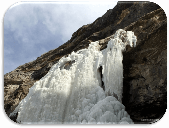
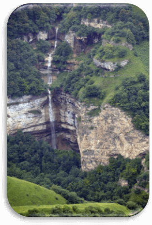
Having passed through the village of Laza, tourists can stop at the foot of the mountain, from which tons of water fall with a roar. The smell of haze and kebab is everywhere. Locals offer everyone to use their services for the preparation of barbecue. Small goat trails lead to the foot of the waterfall. The spectacle is impressive. Water falls from a great height, breaking on the fragments of rocks. From here, from above, the village is clearly visible. To get from the foot of the first waterfall to the second, you have to try pretty hard. To do this, squeeze between the rocks, walk on slippery stones covered with moss, climb up, bypassing streams and overcoming all kinds of obstacles in its path. Looking ahead, I’ll say that it was worth it. After 15 minutes of climbing, you can find yourself at the foot of the second waterfall, where the air, saturated with drops of sprayed water, is so cold that steam is pouring out of the mouth. "If it is so cold in autumn, how cold should it be in winter ?!" the tourist will think. Probably no one goes here in winter ... However, local residents will refute your assumptions, saying that there are no less visitors here in winter than in summer. As a reference, it can be noted that near the village of Laza, not far from each other, there are five waterfalls that freeze in winter, turning into boulder-shaped ice blocks. And then there are competitions in sports ice climbing.
Rest Area "Suvar"
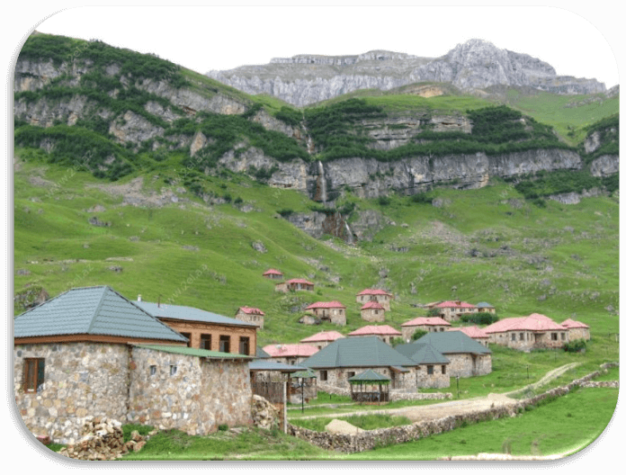
This picturesque place is 2 km from Laza. This is the highest mountain tourist center and base in Azerbaijan which operates in the winter. Its territory is surrounded on all sides by mountains at an altitude of 1850 m above sea level at the foot of Mount Shahdag. Those who wish can spend the night in tents or in sleeping bags. Artificial lakes give this place a very special charm. Those who wish to take mountain walks or climb peaks more than 4,000 meters high can get help from workers in the rest area. You can also contact the locals, considered the best guides in the mountains and knowing literally every centimeter of these places. They will lead you to the plateau Shah Yaglag and Shahnabat Yaglag at an altitude of 3000 m, to the top of Mount Shahdag, whose height is 4242 m, and also to the peak of Heydar Aliyev (3751 m) in the Gizilgaya massif. Horseback riding enthusiasts will enjoy the two-day horseback riding tour of Mount Yarudag. The route is laid along the terraces of the Gusar River - tea, through meadows, crosses streams originating on the slopes of the mountain, leads to the picturesque surroundings of the spring, descends to the grottoes by the river.
"Shahdag Tourist Complex"
In winter, the nature of this highest country in the country is amazingly beautiful. Snow falling already in November lies until March. "Shahdag Tourist Complex" equipped here has all the conditions for winter sports. You can ski, snowboard, climb, etc. The complex has hotels, restaurants, sales and rental of ski equipment, a ski school, etc. The complex operates year-round. The ski season lasts until March and in summer the complex welcomes mountain lovers.

